
All the developers are already moving into this movement. If you are not moving, you will miss it.
Live Projects
Pricing
+ 18% GST
Add-ons — Image to CAD, extra hosting years, CAD change rounds — are priced separately and only if you need them.
Provide your layout drawings in CAD or PDF format for 3D map generation.
Pinpoint your project's geographic coordinates to anchor your project within the precise geographic grid.
Logo, colours, and typography assets to make the dashboard match your corporate identity.
Testimonials
FAQ
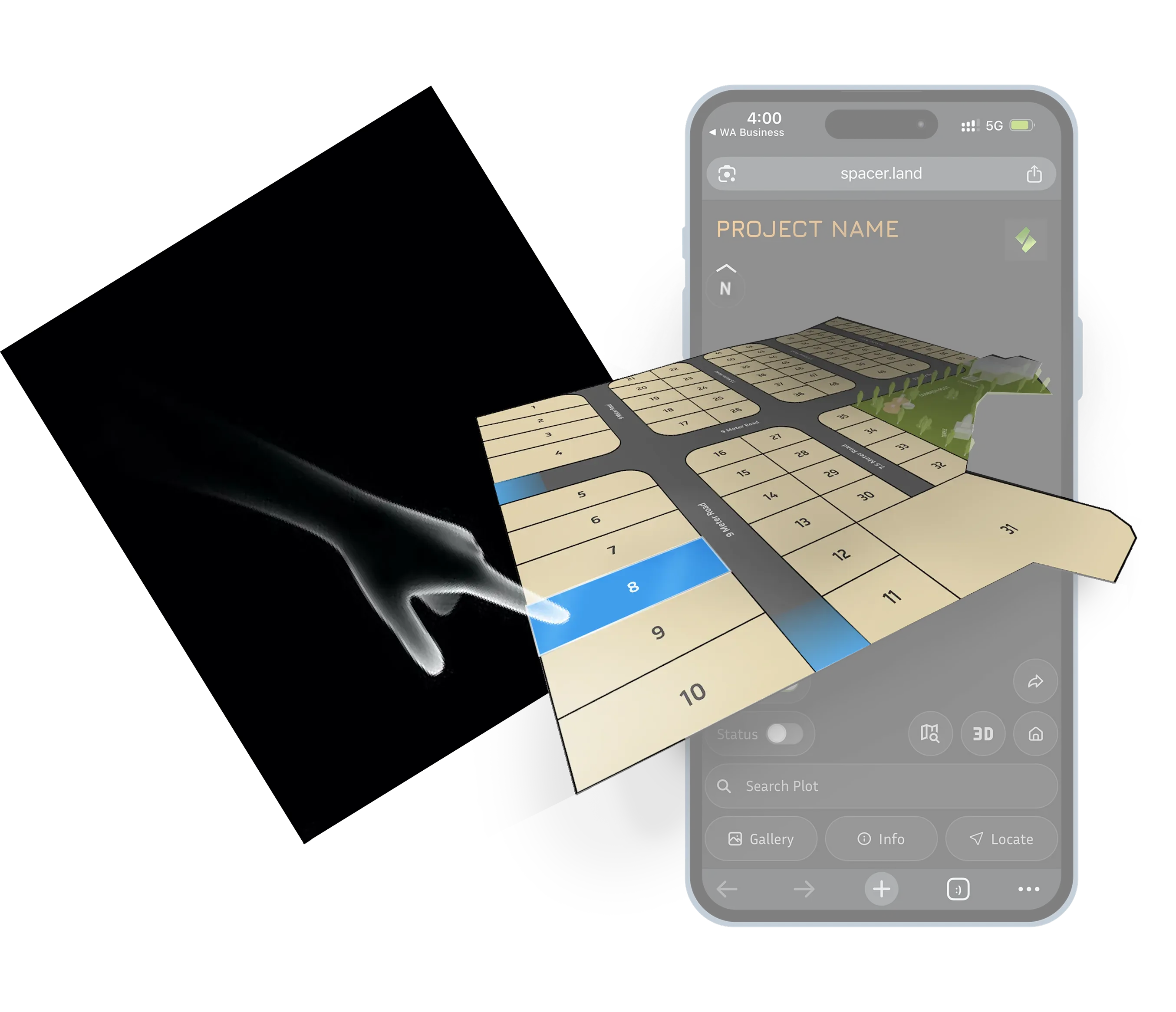
Spacer is a web-based interactive property presentation and inventory experience built for real-estate developers. It turns your existing approved layout into one interactive link that shows plots, dimensions, areas, inventory status, satellite context, 3D visualisation, gallery content, brochure, GPS navigation, zones and project information — replacing the scattered mix of PDFs, brochures, Google Maps links and separate inventory files.
Spacer is currently built for plotted developments — residential plots, commercial plots, industrial plots, farmhouses, villas and row-house developments. Apartments are not supported today. Broader real-estate support is planned for a future update, but we do not commit to a date or to specific functionality.
No. Spacer does not design or approve a real-estate layout. You provide the final project layout or source drawing, and Spacer converts and presents that existing layout as an interactive experience. Layout design, architectural planning, government approvals and site development remain your responsibility.
No. Spacer is a template-based product — your project is adapted into the existing Spacer experience. You can provide branding, project information, gallery content, brochure, inventory statuses, labels, notes and other supported data. Custom UI, custom workflows, custom colours, fonts, loading screens, thumbnails or bespoke features are not part of the standard product.
₹40,000 + 18% GST per project, which covers a three-year hosting period. One Spacer generally represents one marketed project. Add-ons — Image to CAD, extra hosting years and CAD change rounds — are priced separately and only if you need them.
One project = one Spacer. Multiple phases, sectors, survey numbers or thousands of plots can still be a single Spacer if you market them as one project and they form one connected development. If separate land parcels are marketed as separate projects with different project identities, they may require separate Spacers.
AutoCAD/DWG source files are preferred, and vector PDFs also work. The source layout must be accurately sized. Scanned or image-only PDFs cannot be used directly as source files. If a scanned or non-vector source has to be converted into AutoCAD first, an additional ₹10,000 + GST applies and roughly seven working days are needed for the AutoCAD before the Spacer production timeline begins.
With a usable source file, your Spacer is targeted for delivery within 48 hours — two working business days — after the required files are received and accepted by the production team. If AutoCAD has to be created from a scanned or non-vector document first, allow roughly seven working days for the AutoCAD plus two working days for Spacer production, about nine working days in total. The 48-hour clock starts only once the source file is accepted.
Yes. Spacer calculates plot geometry from the source drawing and can display dimensions around irregular shapes, including triangular, curved, corner and polygonal plots. Dimensions come from the source geometry and are not altered by hand. If your legally published area differs from the mathematical geometry, the area can be overridden — but dimensions cannot be changed to an arbitrary value.
Yes. Spacer converts areas into supported units automatically and can display two area units where configured. You can override an individual plot's calculated area when necessary, such as for published or commercially used figures. A broad range of regional units is supported, and an unsupported unit can be evaluated for addition. Dimension units are configurable too, though the actual dimensions stay tied to the source geometry.
You get an admin panel with a simple spreadsheet-like interface. Assign statuses such as Available, Sold, Hold, Reserved, Owner or any custom status, and choose a colour for each. Changes are reflected in the Spacer once the page is refreshed. Bulk status updates are supported by entering multiple plot numbers; range-based updates are not supported yet. Inventory accuracy depends on the admin panel being kept up to date.
Yes. Spacer provides two link modes: an inventory-enabled link and a non-inventory link. Keep the inventory-enabled version for internal and channel-partner use and share the non-inventory version publicly. What a buyer sees depends entirely on which link you share.
Three outcomes, more than any feature list. A far more professional and memorable first impression when the project is shared, especially over WhatsApp. Dramatically better buyer clarity through interactive plots, dimensions, areas, satellite context, 3D and one-link access to project information. And simpler, more current inventory communication through your admin panel. Spacer consolidates what is otherwise scattered across PDFs, brochures, Google Maps links, galleries and inventory sheets.
Yes. Many content changes are complimentary during the three-year period, including gallery content, brochure updates, units, zones and supported information. Changing the underlying base layout is different, because it requires production work: base-layout changes such as adding plots or materially changing the drawing cost ₹5,000 + 18% GST per revision.
Spacer is currently plotted-development focused, template-based rather than fully custom, and it is not a legal or government-approval document. It does not work offline, does not support password-protected Spacers or custom domains, and does not provide buyer-downloadable brochures. Gallery videos are embedded through YouTube links. Labels are public-facing while notes are private, so sensitive information must never be placed in labels.


